Description
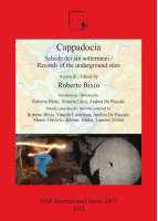
BOOK DESCRIPTIONThis volume presents previously unpublished data (including inter alia plans, photographs, catalogues, sources, geological analyses, water/drainage, travellers' reports) gathered from recent major archaeological investigations into a number of important underground structures from the six districts that together form the territory historically known as 'Cappadocia' (eastern-central Turkey) - Aksaray, Kayseri, Kirsehir, Nevsehir, Nigde and Yozgat. Besides synthetic data (name, location, type, planimetrics), each of the 40 records detailed in this work includes a route-finder, historical and urban-setting notes, descriptions of the underground site and related plan based on instrumental surveys or sketches.


